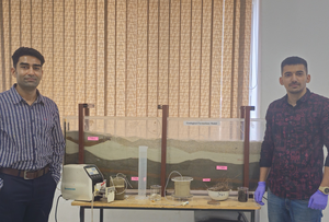
Mandi: Researchers from the Indian Institute of Technology (IIT) Mandi and Jammu have detected cancer-causing pollutants in the groundwater of Himachal Pradesh’s Baddi-Barotiwala (BB) industrial area.
According to the researchers, industrialisation has contaminated groundwater with toxic metals, exceeding permissible limits in the BB industrial area. The reliance on untreated groundwater has caused numerous health problems, including significant reports of cancer and renal disease between 2013 and 2018, they noted in the paper published in the journal Science of the Total Environment.
The team investigated the chemical hydrology of groundwater in the region, identifying dominant ion sources and measuring the geospatial variation of toxic metal concentrations.
The researchers identified key metals of concern and prepared geospatial maps showing metal contamination and health risks across village boundaries.
“Groundwater poses high health risks through oral intake, necessitating urgent remediation. Monitoring industrial effluents for zinc, lead, nickel, and chromium is essential to prevent health hazards. Policies must be framed to balance industrial development with public health for sustainable growth,” said Deepak Swami, Associate Professor, School of Civil and Environmental Engineering, IIT Mandi.
The study also found that the region’s groundwater is rock-dominated, mainly of the calcium carbonate type. Uniform uranium levels were detected in all samples, with most metals traced to industrial sources, while uranium and molybdenum were naturally occurring.
The human health risk assessment revealed high non-carcinogenic risks for both adults and children, primarily due to natural uranium, with additional risks from industrial sources of zinc, lead, cobalt, and barium. Carcinogenic risks were high for adults, mainly from industrial nickel and chromium.
The study highlighted the need for improved effluent treatment to reduce these risks. Geospatial maps were created to show metal contamination and health risks, helping residents understand the situation and identify pollution sources. These maps can guide future policies and remediation efforts.
–IANS


Comments are closed.