
Odisha Govt Urges Collectors to Remain Alert as Depression Intensified Into Deep Depression
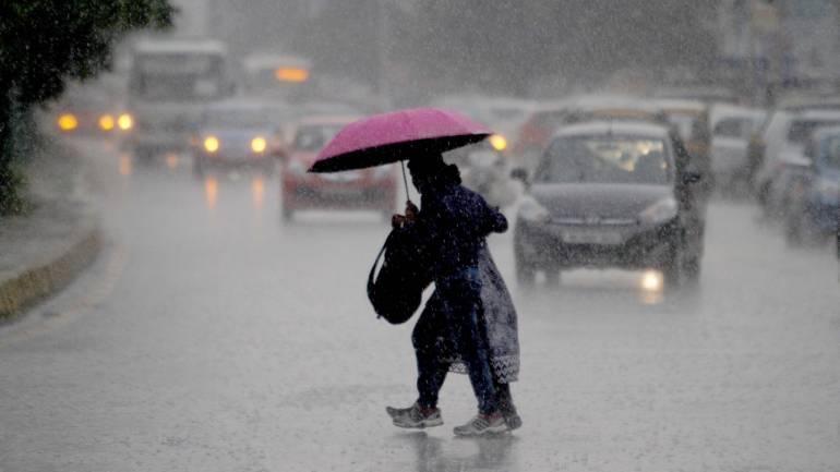
Bhubaneswar: The Odisha Government today urged the Collectors of the districts under Red, Orange and Yellow warning to remain alert for any eventuality arising out of the heavy rain predicted by the Indian Meteorological Department (IMD).
The Special Relief Commissioner (SRC) has issued an advisory to the Collectors in this regard.
“Continuous vigil of low lying areas, dewatering wherever required including urban areas may be taken up. Ensure functioning of control room round the clock. Rainfall may be reported immediately to this office. Situation report may be furnished. Advice for fishermen to be strictly implemented,”the SRC said in a letter to all the concerned authorities.
As per the special bulletin issued by IMD today, the depression over northwest Bay of Bengal & adjoining Odisha coast moved west-northwestwards during past 6 hours with a speed of 5 kmph, intensified into a deep depression and lay centred at 0530 hrs IST of today, the 13th September, 2021, over northwest Bay of Bengal, very close to north Odisha coast, near latitude 20.5°n and longitude 86.9°e, close to southeast of Chandbali, Odisha.
The SRC said: “Latest coastal observations indicate that it further moved west-northwestwards and crossed north odisha coast, close to south of Chandbali between 0530 & 0630 hrs ist as a deep depression with maximum sustained wind speed of 30 knots and lay centred at 0630 hrs ist over north coastal Odisha, very close to Chandbali. It is very likely to continue to move west-northwestwards across north Odisha, north Chhattisgarh & Madhya Pradesh during next 48 hours. It is very likely to weaken into a depression during the next 24 hours.”
WEATHER FORECAST AND WARNING:
HEAVY RAINFALL WARNING
DAY-1: VALID UPTO 0830 HRS OF 14.09.2021 :
Red Warning: Heavy to very heavy rainfall at a few places with extremely heavy (>20cm) falls at one or two places very likely to occur over the districts of Sambalpur, Deogarh, Angul, Sonepur, and Bargarh.
Orange Warning: Heavy to very heavy rainfall at one or two places very likely to occur over the districts of Bolangir, Jharsuguda, Sundargarh, Boudh, Keonjhar, Dhenkanal, Khurda, Jagatsinghpur, Puri and Cuttack.
Yellow Warning: Heavy rainfall very likely to occur at isolated places over the districts of Nuapada, Kalahandi, Kandhamal, Nayagarh, Kendrapada, Balasore, Bhadrak, Jaipur and Mayurbhanj.
DAY-2: VALID FROM 0830 HRS IST OF 14.09.2021 UP TO 0830 HRS 1ST OF 15.09.2021:
Yellow Warning: Heavy rainfall very likely to occur at isolated places over the districts of Bargarh, Jharsuguda, Sundergarh, and Keonjhar.
Fishermen Warning: Surface wind speed reaching 50-60 kmph gusting to 70 kmph very likely along and off Odisha coast and over north & west central Bay of Bengal till 14th Sep, 2021. Sea condition will be rough to very rough. Fishermen are advised not to venture into sea along and off Odisha coast, north and west central Bay of Bengal till 14th September, 2021
Wind Warning for Inland Area of Districts of Odisha: Surface wind speed reaching 35 to 45 kmph gusting to 55 kmph likely over districts of north Odisha, Boudh, Sonepur, Khordha, Puri, Ganjam and Nayagarh districts of south Odisha on l3th September 2021.
Port Warning: Keep hoisted local cautionary signal no. 3 (LC-III) at all ports of Odisha.
Advisory to Collectors: Situation may be closely monitored. Districts under red, orange & yellow warning to remain prepared to meet any water logging / localised flood like situation including urban areas/ possibility of landslides in hilly areas.
Comments are closed.